 |
Englewood
is a small town of approximately 1,500 residents, nestled in the foothills of the Great Smoky Mountains of southeastern Tennessee. The town was originally known as Mortimer and later as Tellico Junction and its early economy was built on its close proximity to the Louisville & Nashville Railroad (later known as the CSX Railroad.) Tourism has also played a factor in Englewood's economy, since the town is located near the Cherokee National Forest. Englewood is part of McMinn County, which is situated along the I-75 and U.S. 411 corridors between the metropolitan areas of Knoxville and Chattanooga, Tennessee. Though considered rural, the area has a significant amount of industry such as Mayfield Dairy Farms, Bowater Newsprint, Johnson Controls, J.M. Huber Corporation, DENSO Manufacturing and Texas Hydraulics. With a transportation network that includes a major interstate, two U.S. highways, numerous Tennessee State highways, and an excellent airport, traveling to McMinn County is easy. The area also offers the kind of hospitality for which the south is well known. Nearby Athens, Tennessee, known as "The Friendly City," offers shopping, restaurants and annual events such as the Annual Travelers Car Show, usually held in July.
Surrounding areas: Johnson City, Tennessee (3.2 mi), Boone Lake, Tennessee (4.9 mi), Jonesborough, Tennessee (7.0 mi), Bluff City, Tennessee (10.3 mi), Big Sandy, Tennessee (11.4 mi), Kingsport, Tennessee (13.6 mi), Hampton, Tennessee (14.4 mi)
|

|
Englewood Vacation Rentals
|

|
|
|
|
|
Englewood Hotels and Resorts
|
|
|
| | | Hotels & Motels |
| Comfort Suites | 3118 Browns Mill Rd | Johnson City, TN | 1.2 mi. | (423) 610-0010 | | Jameson Inn | 119 Pinnacle Dr | Johnson City, TN | 1.5 mi. | (423) 282-0488 | | Ramada Limited | 2606 N Roan St | Johnson City, TN | 2.0 mi. | (423) 282-4011 | | Holiday Inn-johnson City | 101 W Springbrook Dr | Johnson City, TN | 2.1 mi. | (423) 282-4611 | | Super 8 Motel | 108 Wesley St | Johnson City, TN | 2.1 mi. | (423) 282-8818 | | Days Inn | 2312 Browns Mill Rd | Johnson City, TN | 2.6 mi. | (423) 282-2211 | | Red Roof Inn | 210 Broyles Dr | Johnson City, TN | 2.7 mi. | (423) 282-3040 | | Quality Inn & Suites | 207 E Mountcastle Dr | Johnson City, TN | 3.0 mi. | (423) 282-3335 | | Garden Plaza Hotel | 211 Mockingbird Ln | Johnson City, TN | 3.2 mi. | (423) 929-2000 | | The Jam N'jelly Inn | 1310 Indian Ridge Rd | Johnson City, TN | 4.2 mi. | (423) 929-0039 | | Hampton Inn | 508 N State Of Franklin Rd | Johnson City, TN | 4.5 mi. | (423) 929-8000 | | Sleep Inn Inn & Suites | 2020 Franklin Terrace Ct | Johnson City, TN | 5.1 mi. | (423) 915-0081 | | Comfort Inn Of Johnson City | 1900 S Roan St | Johnson City, TN | 5.8 mi. | (423) 928-9600 | | Americinn Lodge & Suites | 376 E Jackson Blvd | Jonesborough, TN | 6.3 mi. | (423) 753-3100 | | Comfort Inn South | 4624 Fairlane Dr | Kingsport, TN | 8.6 mi. | (423) 239-7447 | | La Quinta Inn #935-kingsport | 10150 Airport Pkwy | Kingsport, TN | 9.4 mi. | (423) 323-0500 | | Comfort Inn-elizabethton | 1515 19e Byp | Elizabethton, TN | 10.8 mi. | (423) 542-4466 | | Hampton Inn-Kingsport | 2000 Enterprise Pl | Kingsport, TN | 12.4 mi. | (423) 247-3888 | | Meadowview Conference Resort | 1901 Meadowview Pkwy | Kingsport, TN | 13.1 mi. | (423) 587-6520 | | Cleeks Motel | 2760 East Stone Dr | Kingsport, TN | 13.2 mi. | (423) 228-9996 | | Comfort Inn | 100 Indian Center Ct | Kingsport, TN | 13.3 mi. | (423) 378-4418 | | Econo Lodge | 1704 E Stone Dr | Kingsport, TN | 13.4 mi. | (423) 245-0286 | | Microtel Inn | 1708 E Stone Dr | Kingsport, TN | 13.4 mi. | (423) 390-2110 | | Best Western Colonial Inn | 4234 Ft Henry Dr | Kingsport, TN | 14.9 mi. | (423) 239-3400 | | Holiday Inn Express Hotel & Suites | 1217 Stewball Cir | Kingsport, TN | 14.9 mi. | (423) 723-2300 | | Jameson Inn - Kingsport | 3004 Bays Meadow | Kingsport, TN | 14.9 mi. | (423) 230-0539 | | Ramada Inn Kingsport | 2005 Ln Masa Dr | Kingsport, TN | 14.9 mi. | (423) 245-0217 | | Sleep Inn & Suites | 200 Hospitality Pl | Kingsport, TN | 14.9 mi. | (423) 279-1811 | | Days Inn Kingsport | 805 Lynn Garden Dr | Kingsport, TN | 15.8 mi. | (423) 246-7126 | | Super 8 | 700 Lynn Garden Dr | Kingsport, TN | 15.8 mi. | (423) 246-5515 | | Holiday Inn Express | 2002 Temple HL Rd | Erwin, TN | 16.0 mi. | (423) 743-4100 | | Bristol Lodging Services LLC | 111 Holiday Dr | Bristol, TN | 16.7 mi. | (423) 968-1101 | | Hampton Inn | 3299 W State St | Bristol, TN | 16.7 mi. | (423) 764-3600 | | Regency Inn | 975 Volunteer Pkwy | Bristol, TN | 18.0 mi. | (423) 968-9474 | | Howard Johnson Inn | 2221 Euclid Ave | Bristol, VA | 18.5 mi. | (276) 669-7171 | | Knights Inn | 2221-2 Euclid Ave | Bristol, VA | 18.5 mi. | (276) 669-7171 | | Microtel Inn & Suites Bristol | 131 Bristol East Rd | Bristol, VA | 19.2 mi. | (276) 669-8164 | | Econo Lodge | 912 Commonwealth Ave | Bristol, VA | 19.6 mi. | (276) 466-2112 | | Super 8 Motel Bristol | 2139 Lee Hwy | Bristol, VA | 21.9 mi. | (276) 466-8800 | | Comfort Inn | 2368 Lee Hwy | Bristol, VA | 22.4 mi. | (276) 466-3881 |

|
Englewood Weather & Climate
|

|
|
|
The climate of the northeastern Tennessee mountains is temperate with moderately cold winters and warm, humid summers. Precipitation is fairly well distributed throughout the year; as there is no distinct wet or dry seasons. October has the least rainfall, July the most. Snowfall is quite variable from year to year, and some winters have relatively little. Thunderstorms occur anytime of the year, but are most frequent in spring and summer. Summer temperatures are rarely extreme, but the high humidity often makes it seem hotter than it actually is. Snow is minimal in Tennessee except in the higher mountain regions. Severe storms are infrequent in the state, being east of the center of tornado activity, south of most blizzard conditions, and too far inland to be affected by hurricanes.
|
| Month |
High Temp |
Low Temp |
Rainfall |
Ocean Temp |
| January |
44°F |
24°F |
3.52 in. |
- |
| February |
48°F |
27°F |
3.40 in. |
- |
| March |
58°F |
34°F |
3.91 in. |
- |
| April |
67°F |
42°F |
3.23 in. |
- |
| May |
74°F |
51°F |
4.32 in. |
- |
| June |
81°F |
59°F |
3.89 in. |
- |
| July |
84°F |
63°F |
4.21 in. |
- |
| August |
83°F |
61°F |
3.00 in. |
- |
| September |
78°F |
54°F |
3.08 in. |
- |
| October |
68°F |
41°F |
2.30 in. |
- |
| November |
57°F |
33°F |
3.08 in. |
- |
| December |
47°F |
26°F |
3.39 in. |
- |

|
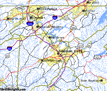
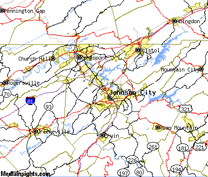
Englewood Map & Transportation
|

|
|
 |
|
|
| Click each thumbnail image to enlarge. |
 |
|
 |
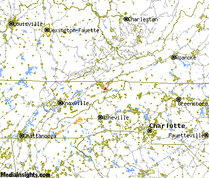 |
The closest airports in the area are the Tri Cities Regional Tn Va airport (TRI) located about 6 miles north of Englewood in Bristol Johnson Kingsport, Tennessee, the Greeneville Greene County Municipal airport (GCY) located approximately 26 miles west of Englewood in Greeneville, Tennessee, the Asheville Regional airport (AVL) located roughly 65 miles south of Englewood in Asheville, North Carolina, the Hickory Regional airport (HKY) located around 71 miles southeast of Englewood in Hickory, North Carolina, and finally the Wilkes County airport (UKF) located about 73 miles east of Englewood in North Wilkesboro, North Carolina.
|

|
Englewood Attractions
|

|
|
| | | Amusement and Theme Parks |
| Ghost Town in the Sky | Maggie Valley | NC | 71.0 mi. | | | NASCAR SpeedPark | Sevierville | TN | 73.7 mi. | | | Dollywood | Pigeon Forge | TN | 76.2 mi. | | | Rockin' Raceway | Pigeon Forge | TN | 76.2 mi. | | | Cherokee Fun Park | Cherokee | NC | 80.6 mi. | | | Santa's Land | Cherokee | NC | 80.6 mi. | |
| | | Golf Courses |
| Pine Oaks Golf Club | Johnson City | TN | 3.2 mi. | | | Elizabethton Municipal Golf Course | Elizabethton | TN | 10.9 mi. | | | Tri Cities Golf Course | Blountville | TN | 11.5 mi. | | | Buffalo Valley Golf Course | Unicoi | TN | 13.3 mi. | | | Cattails at Meadowview Golf Course | Kingsport | TN | 13.6 mi. | | | Crocketts Ridge Golf Club | Kingsport | TN | 13.6 mi. | | | Warriors Path State Park Golf Course | Kingsport | TN | 13.6 mi. | | | Steel Creek Golf Course | Bristol | TN | 17.5 mi. | | | Clear Creek Golf Club | Bristol | VA | 19.2 mi. | | | Graysburg Hills Golf Course | Chuckey | TN | 19.3 mi. | | | Twin Creeks Golf Course | Chuckey | TN | 19.3 mi. | | | Silver Lake Golf Club | Church Hill | TN | 19.8 mi. | | | Scott County Park & Golf | Gate City | VA | 20.1 mi. | | | Andrew Johnson Golf Club | Greeneville | TN | 27.5 mi. | | | Baileyton Golf Club | Greeneville | TN | 27.5 mi. | | | Kinser Park Golf Course | Greeneville | TN | 27.5 mi. | | | River Trace Golf Course | Greeneville | TN | 27.5 mi. | | | Bear Trace at Tims Ford State Park | Winchester | TN | 27.7 mi. | | | Tillery Tradition Country Club | Mount Gilead | NC | 29.0 mi. | |
| | | Ski Areas |
| Ski Beech | Banner Elk | NC | 33.0 mi. | | | Sugar Mountain Ski Area | Banner Elk | NC | 33.0 mi. | | | Hawksnest Golf & Ski Resort | Seven Devils | NC | 34.9 mi. | | | Ski Wolf Laurel | Mars Hill | NC | 38.9 mi. | | | Cataloochee | Maggie Valley | NC | 71.0 mi. | | | Canaan Valley | Davis | WV | 101.7 mi. | | | Scaly Mountain | Scaly Mountain | NC | 107.4 mi. | | | Winterplace | Flat Top | WV | 110.1 mi. | |
| | | State Parks |
| Warriors Path State Park | | TN | 9.0 mi. | | | Natural Tunnel State Park | | VA | 28.7 mi. | |
| | | Museums |
| Carroll Reece Museum | Johnson City | TN | 5.1 mi. | (Multidisciplinary) | | Hands On! Regional Museum | Johnson City | TN | 5.1 mi. | (Children's) |
| | | Zoos and Aquariums |
| Western North Carolina Nature Center | Asheville | NC | 54.3 mi. | | | Knoxville Zoological Gardens | Knoxville | TN | 89.5 mi. | | | Greenville Zoo | Greenville | SC | 105.3 mi. | |
Notice a problem with the information on this page? Please notify us.
|
Disclaimer: We recommend you conduct your own research regarding all accomodations and attractions found on this website. The distances shown on this website are straight-line distances as the crow flies. The road distance may be considerably longer. You assume all liability for use of any information found on this website. No information is confirmed or warranted in any way. By using our services you agree to the terms and conditions of this disclaimer.
|
| We are the #1 site for your Tennessee Vacations presenting Tennessee vacation rentals, hotels, weather and map for each city. |
Tennessee Vacations .com
©1997-2024 All Rights Reserved.
|
|